Rain in Rarotonga may last until the end of the week
Wednesday 11 January 2023 | Written by Matthew Littlewood | Published in National, Weather
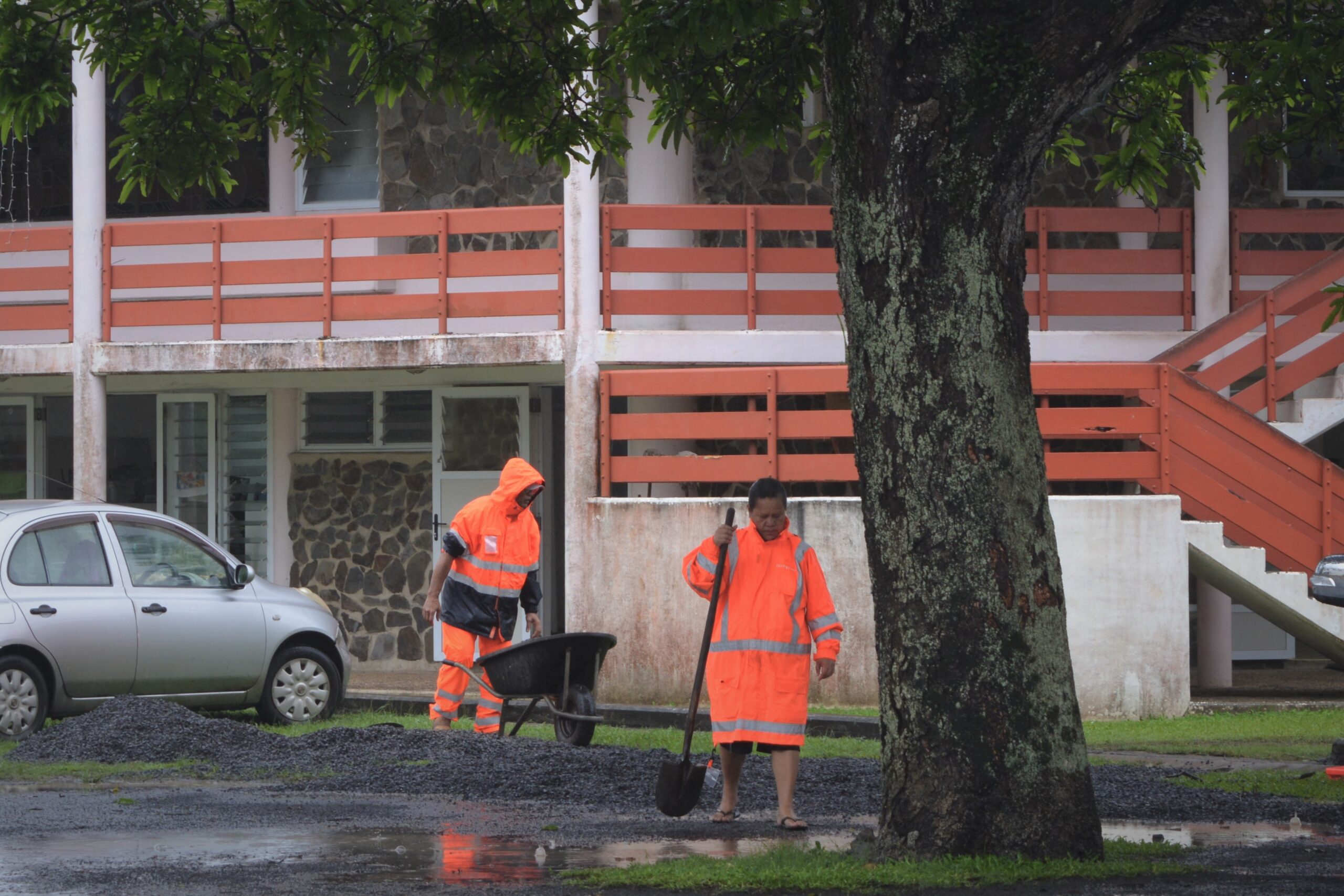
Surface flooding is present across Rarotonga 23011023 / MELINA ETCHES
Torrential rain in Rarotonga may last until the end of the week as a large trough makes its way through the Cook Islands.
Rarotonga recorded 62mm of rain over Sunday and Monday and more is forecast to fall.
MetService forecaster Arona Ngari said two weather systems are behind the heavy downpours, one looping around from the northwest and the other from the northeast of ex-tropical Cyclone Hale which has battered New Zealand in recent days.
"The system I have the most concern about is the one that extends in the direction of the northeast towards the Cook Islands," Ngari said.
"We're expecting it will bring heavy rain in the Cook Islands up until Friday."
Ngari said the unsettled weather system had been in place for a while.
“The persistence of the rain continues, this could turn into local flooding, so we advise people to take care,” he said.
“This system has already hung about for five or so days.”
“This is the busiest time we’ve had for quite a while.”
MetService New Zealand forecaster Matthew Ford told Cook Islands News the outlook for the Cook Islands showed an active trough through the southern group.
“That will produce a low-pressure system that will deepen as it makes its way closer to the islands,” Ford said.
“It’s not expected to become a tropical cyclone, but everyone is keeping an eye on it, as it can still be bad.”
To Tatou Vai water authority spokesman William Tuivaga said all storage catchments are now operating at optimum levels.
This was a massive improvement on the pre-Christmas period, when most of the catchments were running below 50 per cent of optimum levels.
“Everything is going exactly as it should right now,” Tuivaga said.
“However, if we start getting dry spots again, we could be in trouble.”
“People in the Cook Islands consume a large amount of water per person, combine that with leakage and wastage and you have problems.”
Tuivaga said people should be mindful of how easily the situation could change.
“While we are in a time of abundance at the moment, that isn’t necessarily locked in,” he said.
Tuivaga said it was important that people treated water like it was a scarce resource.
“Without water, you’re in trouble,” he said.
“However, I was impressed by the way the people of Rarotonga responded to the previous shortage last month. Most people seemed to get the message.”
As the effects of Hale were ongoing, MetService New Zealand said there was a risk thunderstorms could be severe from late yesterday and overnight in Taumarunui, southern and eastern parts of Taupō, Taihape, eastern parts of inland Taranaki, Whanganui (mainly inland), northern Manawatu, Hawkes Bay (mainly inland, and also south of Hastings), and northern parts of the Tararua District.
With the extent of damage still being assessed, Gisborne Deputy Mayor Josh Wharehinga told New Zealand media the disconnection of the roading network was inhibiting authorities' ability to provide relief to some communities, after some residents had been forced to evacuate.


