


More Top Stories


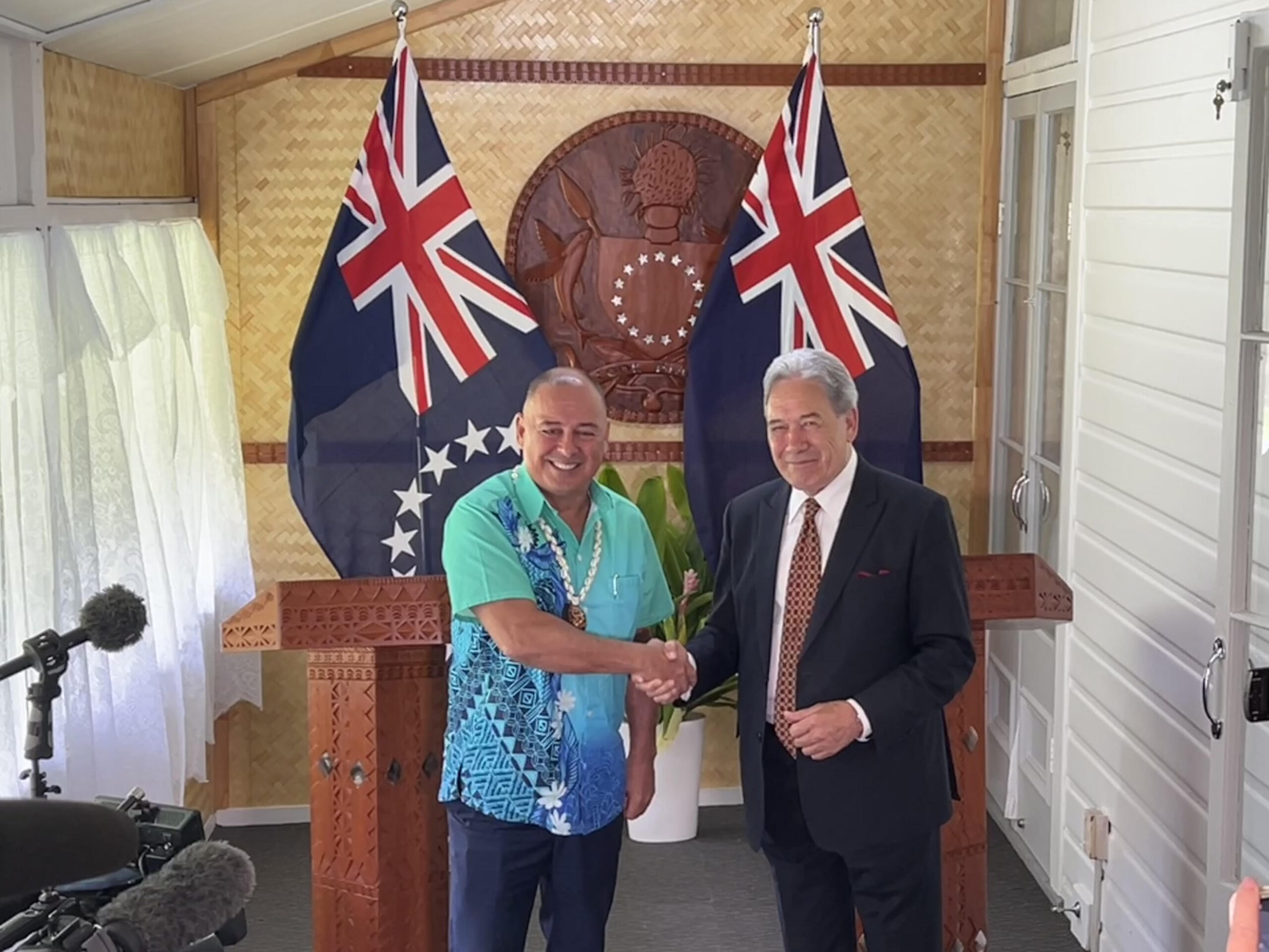
‘Nothing to worry about’: Prime Minister Brown on China agreement
16 February 2025

‘Serious questions’: Opposition challenges China partnership
15 February 2025

No-confidence motion against PM and his Cabinet faces delays
15 February 2025


Ruta Mave: People’s Republic of China red flag
10 February 2025

No debt in China deal
8 February 2025

Thomas Wynne: Haka with the taniwha or dance with the dragon?
8 February 2025

‘Paedophile’ gets 13 years in prison
22 January 2025
Thomas Wynne: Where were our leaders while children suffered?
25 January 2025


$541.7m tourism earnings
25 January 2025
Cook Islands passport proposal
6 January 2025


Top cop position advertised
7 December 2024

Police need numbers and bigger budget
9 December 2024

Niki Rattle: A call for stronger human rights protections
10 December 2024

Solid and Hazardous Waste Bill referred to Parliament committee
10 December 2024


DPM defends CIIC finance and travel policies
6 December 2024


Cook Islands has its first mosque
14 November 2024

CI Muslim opens up about her faith and journey
16 November 2024

RAC to address mosque legality
19 November 2024

I don’t expect much change: PM Brown on US Elections
6 November 2024


Fifth weekly Sydney flight to Rarotonga announced
23 October 2024
CIIC directors seek $350,000 in damages over defamatory claims
21 October 2024
Man found guilty of rape, burglary
24 September 2024

Tenants face water bill burden
8 October 2024


Concerns over Minister’s role in inmate work releases: PAC
5 October 2024

Tourism contribution set to surpass half-billion dollar mark
25 September 2024

Anxiety on the rise: Cook Islands faces mental health challenge
7 September 2024

MCI rejects ‘dark fleet’ label
3 August 2024
PACIFIC – As world leader gathered in New York to sign a historic climate change deal, Pacific islanders are anxiously watching the threatening approach of yet another tropical cyclone.
The Fiji meteorological service says Tropical Cyclone Amos is intensifying and will develop into a category four as it heads closer to the two Samoas.
Tropical Cyclone Amos was upgraded to a category three on Friday and has sustained winds of 148 kilometres an hour which were predicted to increase to 166 kilometres an hour in the next 12 to 24 hours.
A tropical cyclone warning has been issued for the independent state of Samoa, and a tropical storm watch is in effect for American Samoa, including Pago Pago.
The centre of Amos is expected to make its closest approach to Savai’i and Upolu later today.
Fiji Met service forecasters said Amos will pass close to Savai‘i island by midday today as a category four.
While the eye is most likely to pass south of Samoa, it may track close enough to bring some of the eyewall ashore in both Savai‘i and Upolo, according to the US Joint Typhoon Warning Centre.
It says Amos only has a small destructive footprint with hurricane-force winds estimated to extend only up to 40km from the eye.
However, Samoa’s Meteorological Service said the system has the potential to cause flooding, landslides and wind damage.
The majority of homes and buildings on Savai‘i are traditional opened-walled dwellings.
Members of the public must stay alert and be aware of possible flooding due to the cyclone according to Samoa’s disaster management office.
Tropical Cyclone Amos is also likely to affect Tonga’s northern group of islands as it crawls east wards passing 90 kilometres north of the island of Wallis yesterday and not the 50 kilometres that was reported earlier.
Even then, the cyclone caused minor damage on Wallis and power was lost in some places
Yesterday, the National Weather Service in Pago Pago placed the territory under a storm watch and issued a high surf warning.
Radio New Zealand’s correspondent Fili Sagapolutele says officials have told locals to start preparing for Amos.
“They are asking people who live along the shoreline to be mindful of this situation and to be prepared to move as soon as those high surfs start hitting the territory.”
The high surf warning has been issued for all islands of American Samoa. Surf heights are expected to build to seven metres Saturday and Sunday off the offshore reefs.
Other impacts will include coastal erosion and strong rip currents.
The Samoa Meteorology Division is warning of river overflows, slippery road conditions, poor visibility, flooding, landslides and flying objects.
On its forecast track, the strongest winds are expected to particularly impact the island of Savai‘i and its higher terrain.
Hurricane force winds are likely to down trees, trigger power outages, and lead to at least some structural damage to buildings.
Storm surge flooding is likely particularly along the north-facing coasts of both Savai’i and Upolu, compounded by battering waves riding atop the surge.
Amos has the potential to dump anywhere from 125 to 500 millimetres of rain across Samoa and American Samoa, leading to dangerous, life-threatening flash flooding and mudslides through Sunday.
Pago Pago has already picked up almost 485 millimetres of rain through the first three weeks of April, which is almost 203 millimetres above average for the entire month.
Amos is likely to be the strongest tropical cyclone to affect Samoa and American Samoa since Cyclone Evan in mid-December 2012.
In just over 26 years of record, only five category four equivalent tropical cyclones have tracked near Samoa, the last of which was Olaf in February 2005.
- PNC