Unfavourable weather set to continue
Thursday 20 January 2022 | Written by Al Williams | Published in National, Weather

Wet weather continues to batter Rarotonga.
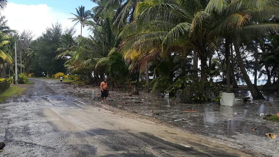
Cook Islands continues to be pounded by strong gale force winds, rough seas and intense rainfall as a new tropical disturbance has made its way here.
In the past 24 hours TD4F, the fourth tropical disturbance sighted in the South Pacific region during the 2021-22 cyclone season, has moved away from the Cooks towards the west.
“Not long after that, TD05F came on the scene,” Arona Ngari, director of the Cook Islands Meteorological Service said.
“This is currently located in between the Ngaputoru and Rarotonga with strong gale force winds, rough seas and intermittent high intensity rainfall,” he said yesterday.
“People are encouraged to heed the warnings and to stay away from the coast, and be mindful also of the high tides in their local areas.”
Gale and heavy warnings remain in place for land areas and waters across the southern Cooks.
Rarotonga and Mauke can expect gale force winds up to 65 kmph with gusts up to 90 kmph – periods of rain with squally thunderstorms are all forecast for the two islands.
The rest of the southern Cooks can also expect gale force winds of 65 kmph with gusts up to 90 kmph, with some showers and isolated thunderstorms.
On the water Rarotonga and Mauke can expect gale force winds up to 50 knots, very rough to high seas, and heavy to damaging swells.
The rest of the southern Cooks waters can also expect gale force winds up to 50 knots and rough to very rough seas.
Cook Islands Meteorological Service yesterday issued a Special Weather Bulletin which said possible impacts included isolated damage to free branches, some houses of light materials or unshielded structures in exposed communities.
A high risk warning is in place for sea travel with risky hazardous breaking waves and coastal inundation along low lying coastal areas.


